3 min read

For years, the phrase “digital curb” lived mostly in planning documents, conference panels, and future-forward mobility conversations. It described an urban vision where every parking space, sign, rule, loading zone, EV space, and time restriction could be represented as structured, interoperable data.
Today, parts of that vision are becoming real in cities. While maturity varies, the direction of travel is clear: the curb is increasingly treated not just as physical assets but as an information system.
This shift is fundamentally changing how parking and curbside operations work. The digital curb is no longer an abstract future concept. It’s becoming a core part of modern civic infrastructure.
Why the Digital Curb Is Moving From Vision to Infrastructure
Historically, curbside rules and assets have been managed in very manual ways. Even cities seen as digitally advanced still rely on processes that are far from modern, including:
- Regulations stored in PDFs
- Sign inventories kept in GIS layers
- Parking meter configurations held in vendor portals
- Temporary curb changes communicated via press releases
- EV charging data isolated in operator platforms
This fragmentation is one of the biggest hidden inefficiencies in modern urban mobility. When curb information is scattered or static, parking operations become reactive, enforcement becomes inconsistent, and policy outcomes become difficult to measure.
The push toward a fully digitized curb comes from several converging pressures:
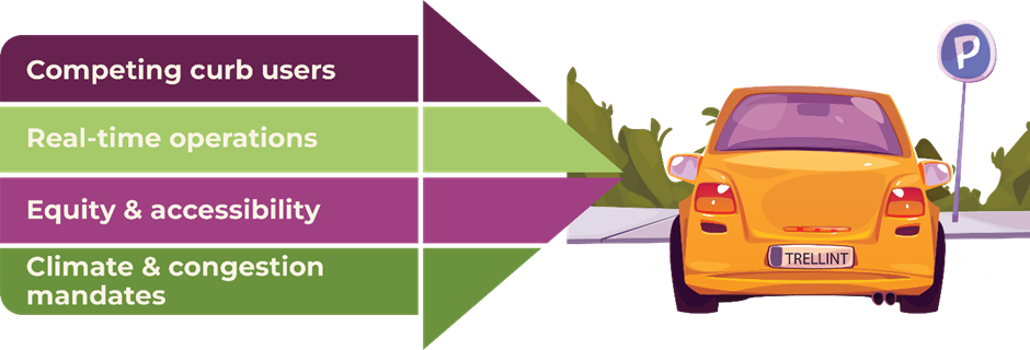
1. Growth in demand from competing curb users
Delivery fleets, ride‑hail, micro‑mobility, public transit, freight, and private vehicles all rely on finite curb space. Without structured data, cities cannot allocate space dynamically, plan for peak demand, or set fair rules.
2. The rise of real‑time operations
Modern mobility depends on real-time guidance, occupancy insights, dynamic pricing, and automated enforcement triggers. These systems require the curb to exist not as text but as executable logic.
3. Equity and accessibility goals
As cities aim to improve accessible parking, enforce ADA rules, and mitigate enforcement bias, they need accurate curb data that can be embedded into workflows and audited.
4. Climate and congestion mandates
Reducing circling, managing EV charging, and supporting low emission zones all depend on knowing curb availability, restrictions, and use patterns.
In short, cities can’t manage what they can’t see. Digitizing the curb is foundational to running today’s curbside operations efficiently and sustainably.
What “Digitizing the Curb” Actually Means
Digitizing curb assets and rules does not simply mean mapping them. It means structuring all curb information so it can be machine readable, interoperable, and operational including:
- Physical assets
Meters, signs, road markings, EV chargers, loading zones, bike racks, parking spaces, bus lanes, taxi ranks. - Regulations and rules
Time limits, pricing schedules, exemptions, permit eligibility, peak hour restrictions, event-based rules, temporary changes - Rights and permissions
Which vehicles may stop, dwell, park, unload, charge, or pass through and under what conditions. - Contextual metadata
Usage patterns, occupancy levels, adjacent land use, and enforcement zones.
When these elements are encoded digitally and consistently, the curb becomes programmable and data is available and kept current.
How Cities Can Start Curb Data Collection Smartly and Cost‑Effectively

Cities don’t have to start with expensive hardware programs. Most build a baseline quickly and affordably by:
- Starting with what already exists: convert current sources into a common data format and fill obvious data gaps first.
- Using event‑based updates: embed updates into existing workflows so that anytime a sign or rule changes, the digital record updates automatically.
- Leveraging partners and standards: existing system feeds can be integrated and shared in a consistent format, reducing duplicate work across teams.
- Iterating the model: treat it as living data and improve accuracy over time rather than aiming for costly “perfect” coverage on day one.
The Operational Impact of a Real Digital Curb
A truly digital curb changes how parking and curbside operations function day-to-day. It shifts both from a manual, interpretive model to a data-driven, automated one:
More accurate and consistent enforcement
Rather than relying on memory or static rulebooks, enforcement systems can validate vehicles against real-time rules. This reduces disputes, improves fairness, and supports compliance rather than strictly punitive outcomes.
Better experiences
Drivers can see real-time parking options, understand restrictions clearly, and avoid violations. Digital clarity reduces complaints, increases payment rates, and improves public trust.
With a single source of truth for curb rules and assets, cities can better align payments, citations, and collections. This minimizes revenue leakage and simplifies reconciliation across multiple vendors.
Insight-driven planning
A digital curb makes it possible to measure occupancy trends, equity impacts, compliance hotspots, and the effectiveness of interventions. This elevates curbside management from tactical to strategic.

How Trellint Helps Cities Turn the Digital Curb into Real Infrastructure
Trellint provides a vendor-neutral integration and policy layer that brings together curb regulations, payment data, permit information and other operational feeds a city already manages.
Where supported, this means enforcement workflows can validate vehicles against live rules, payments and citations can align to a single source of truth, and analytics teams can work from unified, accurate datasets.
For cities still developing their digital inventory, Trellint’s approach allows them to start with what they already have and expand as new data becomes available. This ensures progress is incremental and achievable without requiring a costly, all‑at‑once data collection effort.
To find out how Trellint can help your city contact us today to find out more.


-1.jpeg)